
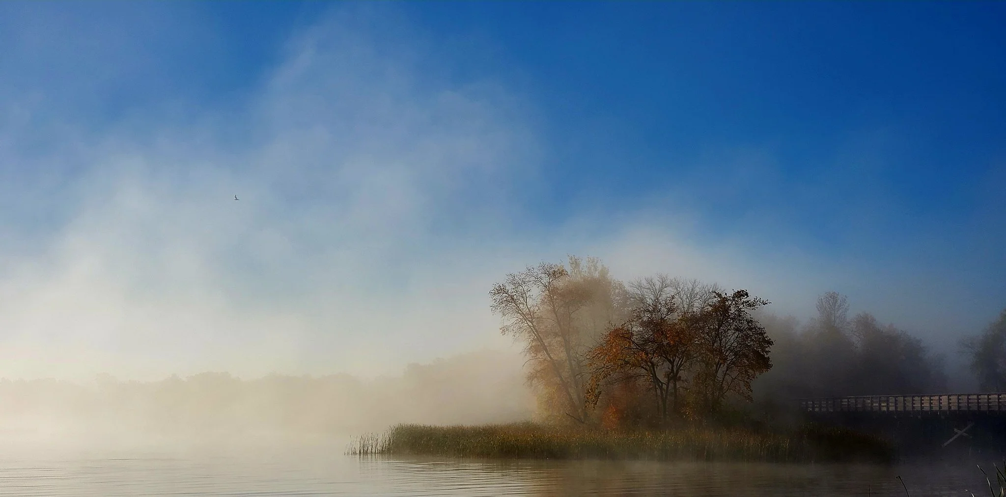
Ion Lakes
Professional mapping of surface water quality conditions to empower homeowners, anglers, investors, and environmental stewards.
Our Services
-
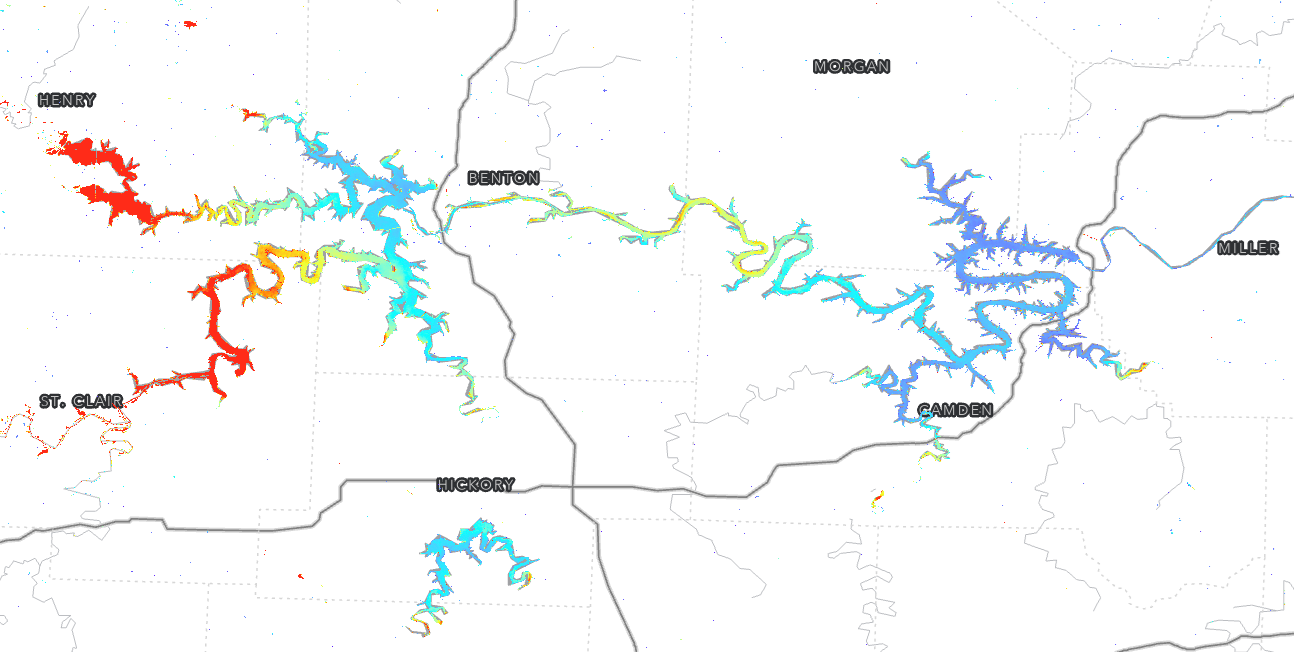
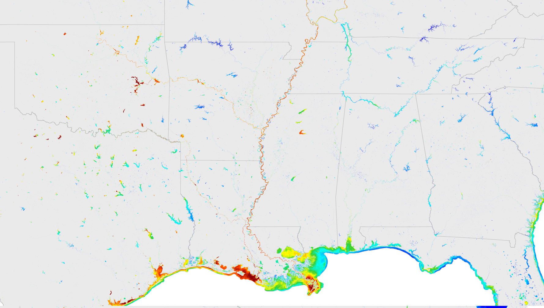
Mapping
At Ion Lakes, we provide access to affordable surface water quality basemaps derived from Earth Observing (EO) imaging satellites and designed for seamless integration into marine electronics and mapping platforms.
-
Monitoring
We offer ongoing monitoring services and ecological insights to track changes in surface water quality conditions over time—empowering water resource managers, conservation groups, and recreational users with actionable, up-to-date insights.


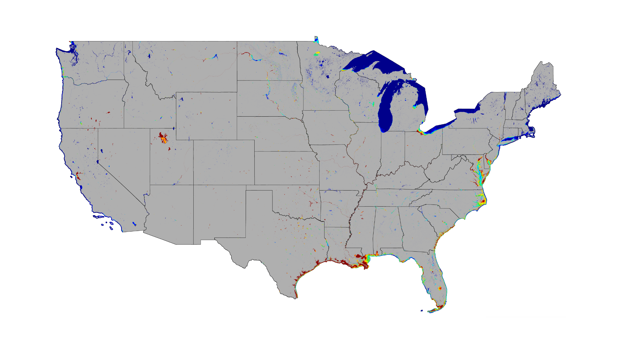
Disclaimer: Sample products shown do not reflect the complete package delivered to the customer.
How can we help you?
Interested in recreational water quality? Whether you're planning a project, exploring routine monitoring options, or just curious about what other services Ion Lakes can offer—let’s start the conversation.
© 2025 Ion Lakes, LLC. All rights reserved.
Ion Lakes is a registered Limited Liability Company. The content on this website is provided for general informational purposes only.